Asheville Adventure Travel Guide
The adventure traveler's guide to Asheville: seasons, logistics, getting around, and the best basecamps.

Asheville, United States

About Asheville
Asheville is a city in Buncombe County, North Carolina, United States. Located at the confluence of the French Broad and Swannanoa rivers, it is the county seat of Buncombe County.
Read more on WikipediaQuick Facts
The U.S. State Department does not issue travel advisories for domestic U.S. destinations. This score reflects a normal-precautions baseline; always check current local conditions.
Welcome to Asheville – The Adventure Hub of the Blue Ridge
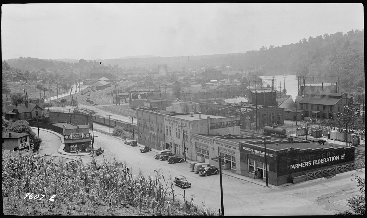 Photo: French Broad River flood plain as viewed from Asheville - NARA - 281084 by Tennessee Valley Authority (Public domain), via Wikimedia Commons
Strap on your pack, load the bike, and bring the kayak—Asheville sits at the crossroads of river canyons, forested peaks, and a vibrant, gear‑friendly community. At roughly 2,130 ft (650 m) above sea level, the city offers a comfortable altitude for high‑energy pursuits without the thin‑air penalties of higher mountain towns. With a 2024 population estimate of just under 100 k (≈98,270) spread over 45.86 sq mi of land, you’ll find the urban core dense enough for a good supply of gear shops and food‑fuel stops, yet spacious enough to slip out onto backcountry trails in minutes (Wikipedia). The French Broad and Swannanoa rivers converge right in town, delivering instant access to white‑water runs, fly‑fishing, and riverside canyoning (Wikipedia). Whether you’re a mountain‑bike shredder, a rock‑climbing purist, or a multi‑day trekker, Asheville is the launchpad that lets you swap city comforts for wilderness thrills in a single breath.
Neighborhoods to Know
 Photo: Asheville River Arts District Photographed with a Canon EOS 3 on Ilford Film by Bill McMannis (CC BY 2.0), via Wikimedia Commons
Asheville’s layout is less a patchwork of distinct districts and more a seamless gradient from downtown hustle to mountain fringe. The city’s compact footprint means you can park your rig in the heart of the River Arts District, grab a coffee, and be on a trailhead within ten minutes. Because official neighborhood data isn’t supplied, we’ll keep the focus on the functional zones that matter to adventure travelers:
Downtown & River Arts District
Home to the majority of bike shops, outdoor‑gear co‑ops, and the city’s main transit hub. The streets double as a street‑art gallery and a quick‑access point to the French Broad River launch sites.
West Asheville
A laid‑back enclave with a growing community of indie bike builders and craft‑brew pubs—perfect for refueling after a long ride.
Southside (Biltmore Village)
Nestled near the iconic Biltmore Estate, this area offers easy road‑bike routes that climb into the Blue Ridge and access to the Swannanoa River trail network.
Top Things to Do in Asheville
 Photo: Biltmore House (7867896948) by Teemu008 from Palatine, Illinois (CC BY-SA 2.0), via Wikimedia Commons
- Biltmore Estate — America’s largest privately owned house, this 250-room Gilded Age chateau built for George Vanderbilt sits on thousands of acres of gardens, forest, and river frontage on Asheville’s south side. Ride or drive the estate roads before you hit the trailheads.
- Blue Ridge Parkway — This 469-mile scenic ridgeline drive linking Shenandoah and Great Smoky Mountains National Parks runs right past Asheville, stacked with overlooks, hiking trailheads, and some of the best road-cycling miles in the East.
- Pisgah National Forest — Over 500,000 acres of national forest south and west of the city hold waterfalls, singletrack mountain-bike trails, and the Davidson River’s blue-ribbon trout water.
- French Broad River — One of the oldest rivers on the continent runs straight through downtown, delivering white-water rapids, flatwater paddling, and riverside greenways in a single stretch.
- Mount Mitchell — The highest peak east of the Mississippi River at 6,684 ft, Mount Mitchell is roughly a 35-mile drive from Asheville and offers a summit trail and sweeping Blue Ridge views.
- River Arts District — A mile-long stretch of former industrial warehouses along the French Broad now packed with working artist studios, galleries, and breweries — a great flat loop between river put-ins.
Book tickets & skip-the-line tours: Browse Asheville experiences
Getting Around
 Photo: Craggy Gardens NC1 by Acroterion (CC BY-SA 4.0), via Wikimedia Commons
Asheville’s streets are designed for cyclists first. Dedicated bike lanes thread through downtown and spill onto the historic Blue Ridge Parkway and Trans‑Allegheny Trail, giving you a low‑traffic, scenic conduit to the surrounding wilderness. If you’re hauling a rack‑loaded bike or a kayak, the city’s modest size (≈45.86 sq mi of land) means a short drive or even a well‑planned bike commute gets you to most trailheads. Public transit runs on a loop that stops near major outdoor retailers, but most adventure crews prefer a sturdy mountain bike or a compact SUV for the flexibility to chase weather windows and spontaneous trail discoveries.
Safety & Practical Notes
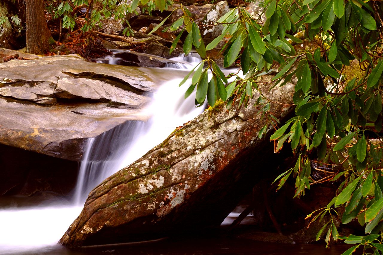 Photo: Davidson River Pisgah Nat Forest by Gary Stevens from Asheville NC (CC BY 2.0), via Wikimedia Commons
The U.S. State Department does not issue travel advisories for domestic U.S. destinations like Asheville — it rates only international destinations, and Asheville carries no advisory (domestic) as of 2026-07-08. That said, normal precautions apply, especially in the backcountry.
Water: Asheville’s municipal water supply meets U.S. EPA Safe Drinking Water Act standards. When you’re refilling your hydration pack after a long ascent, you can trust the tap — just keep an eye on local notices if you’re venturing into the outer suburbs on private wells.
Power: The city follows standard U.S. plug configurations, so bring a 2‑pin or 3‑pin plug adapter if you’re traveling from abroad. No special voltage concerns—just the usual 120 V, 60 Hz.
Emergency Services: The United States uses 911 for police, fire, and medical emergencies. Keep this number programmed into your phone, and consider downloading a local offline map app that marks the nearest hospitals and ranger stations.
Geography & Weather: At an elevation of about 2,130 ft, weather can shift quickly, especially when you head up into the surrounding Blue Ridge. Pack layers, a waterproof shell, and always check the river flow levels before launching into the French Broad or Swannanoa. The city’s coordinates—35°35′44″N 82°33′07″W—place it in the Eastern Time Zone, so plan your daylight hours accordingly (Wikipedia).
Regulations & Permits: For river runs, the U.S. Forest Service manages many of the access points downstream of Asheville. Most day trips require no permit, but multi‑day white‑water expeditions may need a U.S. Forest Service or state park permit. Check the City of Asheville Official Website for the latest on river safety alerts and trail closures.
Best Time to Visit
 Photo: Mt-Pisgah-Fall by PBarn424 (CC BY-SA 4.0), via Wikimedia Commons
Asheville’s adventure calendar is dictated by the rhythm of the mountains rather than a fixed “high season.” Spring brings swollen river flows ideal for kayaking, while the cooler temperatures make for comfortable trail running and mountain biking. Summer’s longer daylight hours open up extended ridge‑top climbs and late‑evening bivies. Fall paints the Blue Ridge in a blaze of color, perfect for scenic bike rides and photo‑ops at sunrise. Winter can be a quiet time for snowshoeing and backcountry skiing on nearby peaks, though river levels may drop. Because we lack specific month‑by‑month data, we recommend checking local river gauges and trail reports before you lock in your itinerary.
Where to Stay
 Photo: Arcade Building by Teemu08 (CC BY-SA 3.0), via Wikimedia Commons
Base yourself where you can reload your gear and still feel the pulse of the city. Asheville’s lodging scene ranges from boutique hostels tucked in the River Arts District to mountain‑lodge cabins on the outskirts that double as gear‑storage hubs. For a curated list of adventure‑ready hotels and lodges that cater to the gear‑centric traveler, check out our full hotel guide.
Frequently Asked Questions
What's the best way to transport a full bike rack and kayak to a trailhead?
Load both onto a compact SUV or a hatchback with a roof rack. Asheville's streets are bike-friendly, so you can also bike-haul a folded bike to many trailheads within the city limits.
Are there any water-quality concerns for drinking straight from the French Broad River?
The river is a popular recreation spot, but it's not treated for drinking. Always filter or treat river water before consumption. Municipal tap water in Asheville meets EPA Safe Drinking Water Act standards.
How do I stay connected in remote mountain areas?
Cellular coverage is solid in downtown Asheville and along major roadways. Once you venture deeper into the Blue Ridge, signal can fade. Carry a satellite messenger or a local radio if you plan extended backcountry trips.
Do I need a special permit for day-long white-water runs on the French Broad?
Most day trips on the French Broad don't require a permit, but it's wise to verify current regulations with the City of Asheville or the local river-ramp office before you launch.
Upcoming Holidays
United StatesGet price-drop alerts and new guides from BoldTripGuide
One email a week: price drops on the gear we recommend, new guides, and what changed. No spam, unsubscribe anytime.