Travel Guide to Moab, United States
The red rock adventure capital of the American Southwest, Moab delivers world-class mountain biking, canyoneering, rock climbing, and off-road driving between two stunning national parks.

Moab, United States

About Moab
Moab was an ancient Levantine kingdom whose territory is today located in southern Jordan. The land is mountainous and lies alongside much of the eastern shore of the Dead Sea.
Read more on WikipediaQuick Facts
The U.S. State Department does not issue travel advisories for domestic U.S. destinations. This score reflects a normal-precautions baseline; always check current local conditions.
Why Adventurers Love Moab
 Photo: Skyline Arch at Arches National Park by Sanjay Acharya (CC BY-SA 3.0), via Wikimedia Commons
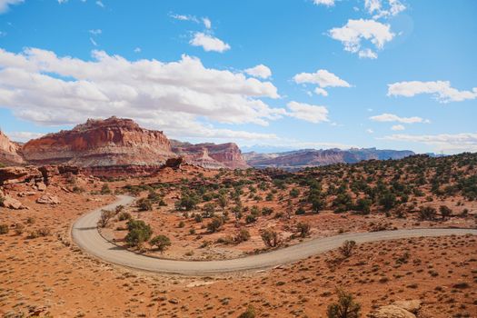
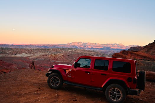
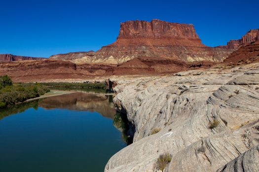
Moab is a small desert town squeezed between two of America’s most spectacular national parks — Arches and Canyonlands — and surrounded by millions of acres of red rock wilderness. The Slickrock Trail put Moab on the mountain biking map in the 1980s and the riding has only expanded since, with the Whole Enchilada, Porcupine Rim, and dozens of other trails carving through sandstone mesas and desert canyons. Beyond biking, Moab is a world-class destination for canyoneering, rock climbing, whitewater rafting on the Colorado River, and off-road driving on trails like Hell’s Revenge. The landscape is alien and vast — red sandstone arches, towering buttes, and deep slot canyons under enormous desert skies.
Neighborhoods to Know
 Photo: Moab, Utah downtown by Quintin Soloviev (CC BY 4.0), via Wikimedia Commons
Main Street / Downtown — Moab’s commercial spine holds most hotels, hostels, gear shops, and restaurants, and it’s the natural base if you want to walk to dinner after a day on the trail.
Highway 128 / River Road corridor — The two-lane road tracing the Colorado River northeast of town toward Fisher Towers is lined with free BLM camping and is the access point for Negro Bill Canyon-area hikes and rafting put-ins.
Spanish Valley — The residential valley south of downtown toward the Utah-Colorado border, with quieter lodging and closer access to the La Sal Mountains foothills.
Sand Flats Recreation Area — The slickrock plateau just east of town that holds the Slickrock Trail and Hell’s Revenge; a fee area with its own campground for bikers and off-roaders who want to be first on the trail.
Top Things to Do in Moab
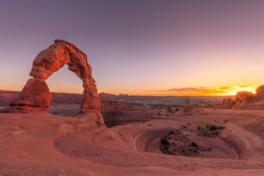
 Photo: Delicate Arch in Arches National Park 3 by Jonathan Zander (Digon3) (CC BY-SA 3.0), via Wikimedia Commons
- Arches National Park — More than 2,000 natural sandstone arches packed into one park, the highest density on Earth. Bike-friendly roads and short hikes make it easy to see several in a single day.
- Delicate Arch — The freestanding 52-foot arch on Utah’s license plate. The 3-mile round-trip trail gains 480 feet and ends on a narrow ledge — go for sunset.
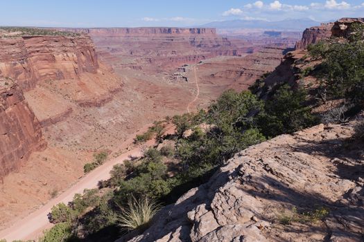
- Canyonlands National Park — A 337,598-acre maze of canyons and mesas carved by the Colorado and Green Rivers. The Island in the Sky district, closest to Moab, draws most visitors for its rim-top hiking and biking.
- Dead Horse Point State Park — A 5,900-foot overlook of the Colorado River carving through Canyonlands below — the shot you’ve seen in a dozen car commercials and films.
- Fisher Towers — Sandstone spires up to 900 feet tall with more than 70 established climbing routes, plus a hiking trail that circles the base for anyone who’d rather look up than climb.
- Grandstaff Canyon — A shaded desert canyon (formerly called Negro Bill Canyon) reachable from Highway 128, with swimming holes and the 943-foot Morning Glory Natural Bridge about 2.5 miles in.
Book tickets & skip-the-line tours: Browse Moab experiences
Getting Around
 Photo: Utah La Sal loop road in winter by Eikko (CC BY-SA 4.0), via Wikimedia Commons
A car is essential in Moab. Arches National Park entrance is 5 minutes north of town, Canyonlands Island in the Sky district is 30 minutes. Mountain bike trailheads are scattered around the area. Several outfitters offer shuttle services for one-way rides like the Whole Enchilada. Grand Junction, Colorado has the nearest commercial airport (1.5 hours). Salt Lake City is 4 hours north.
Safety
 Photo: A281, Fisher Towers, Utah, USA, 2008 by Brian W. Schaller (FAL), via Wikimedia Commons
The U.S. State Department does not issue a travel advisory for Moab — it rates all domestic U.S. destinations Level 1 (No advisory, domestic) (as of 2026-07-08). The real hazards here are environmental rather than criminal: summer temperatures regularly exceed 100°F and turn midday hikes dangerous, flash floods can fill slot canyons within minutes of a storm far away, and many trailheads and canyons have no cell service. Carry more water than you think you need, check the weather before entering any canyon, and let someone know your route if you’re heading into the backcountry.
Best Time to Visit
 Photo: La Sal Mountains, Utah by Ken Lund (CC BY-SA 2.0), via Wikimedia Commons
Spring (March-May) and fall (September-November) bring the mild, dry weather that makes Moab’s outdoor activities enjoyable — daytime highs in the 60s-80s°F with the snow-capped La Sal Mountains as a backdrop. Summer regularly tops 100°F, which makes midday biking or canyoneering miserable and dangerous; if you visit in summer, plan activities for early morning or evening. Winter is quiet and cold but still workable for shorter hikes and photography, with occasional snow dusting the red rock.
Where to Stay
 Photo: Jailhouse-Cafe in Moab-Utah-USA by Saalebaer (CC0), via Wikimedia Commons
Moab’s Main Street has the majority of hotels, hostels, and restaurants. Budget travelers should check the Lazy Lizard Hostel ($15-25/night for dorms) or camp at BLM land outside town (free dispersed camping on public land). Mid-range options include motels on Main Street ($70-110/night) or cabin rentals. Campgrounds inside Arches and Canyonlands book months in advance — reserve early. The BLM areas along Highway 128 and Highway 313 offer free camping with stunning canyon views, though they fill up on spring and fall weekends. See our full basecamp hotel guide for specific picks.
Budget Tips
 Photo: Grandstaff Canyon Hike by BLMUtah (Public domain), via Wikimedia Commons
Free dispersed camping on BLM land saves a fortune — bring your own water and supplies. Buy an America the Beautiful pass ($80/year) for unlimited national park access. Bring your own bike if possible — rentals run $60-80/day for a good full-suspension rig. Spring and fall have the best weather; summer temperatures exceed 100°F and make outdoor activity miserable midday. Fill up on gas in town — there is nothing for miles in any direction.
Frequently Asked Questions
Do I need a visa to visit Moab?
No visa is required for US citizens. International visitors follow standard US entry requirements -- either the ESTA visa waiver or a visitor visa, depending on your home country.
Is Moab safe, including at night?
Yes. Moab is a small town with low crime, and the U.S. State Department issues no domestic travel advisory. The real risks here are environmental, not criminal: summer heat, flash floods in slot canyons, and exposure on remote trails with no cell service. Plan around those, not around personal safety at night.
What's a realistic daily budget in Moab?
Expect $60-120/day. Budget travelers can camp free on BLM land or stay in hostel dorms for $15-25/night; mid-range motels on Main Street run $70-110/night. Add gear rental ($60-80/day for a full-suspension bike) and park entrance fees or an $80/year America the Beautiful pass.
Do I need a car to get around Moab?
Yes, a car is essential. Arches National Park is 5 minutes from downtown and Canyonlands' Island in the Sky is about 30 minutes, but trailheads and BLM camping areas are spread across a wide area with no public transit. Outfitters run shuttles for one-way rides like the Whole Enchilada.
Related Guides
Upcoming Holidays
United States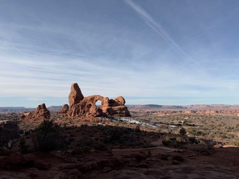
Get price-drop alerts and new guides from BoldTripGuide
One email a week: price drops on the gear we recommend, new guides, and what changed. No spam, unsubscribe anytime.