Puerto Natales Adventure Travel Guide
The adventure traveler's guide to Puerto Natales: seasons, logistics, getting around, and the best basecamps.

Puerto Natales, Chile

About Puerto Natales
Puerto Natales is a city in Chilean Patagonia. It is the capital of both the commune of Natales and the province of Última Esperanza, one of the four provinces that make up the Magallanes and Antartica Chilena Region in the southernmost part of Chile...
Read more on WikipediaQuick Facts
Safety score derived from the U.S. State Department Travel Advisory for Chile: Level 2 (Exercise Increased Caution), as of 2026-07-08. Country-level guidance; check local conditions before you go.
Welcome to Puerto Natales – The Patagonian Launchpad
 Photo: Puerto Natales Chili vue de la mer.JPG by Pierre cb (Public domain), via Wikimedia Commons
Nestled at 51°44′S 72°31′W, Puerto Natales is the southernmost gateway to some of the world’s most rugged wilderness, according to Wikipedia. With a 2024 population of roughly 21,152 (CityPopulation), this Chilean town punches well above its weight, serving as the primary access point to Torres del Paine National Park – the crown jewel of Patagonia’s mountain‑and‑glacier arena. Founded on May 31 1911 as a humble sheep‑industry port (Wikipedia), the town has reinvented itself: tourism now dominates the local economy, flanked by cattle and aquaculture (Wikipedia).
For adventure‑hungry travelers, Puerto Natales is less a destination than a staging ground. The town’s compact layout, low‑key vibe, and proximity to world‑class trekking, climbing, and kayaking terrain make it the perfect basecamp. Whether you’re plotting a multi‑day trek across the Paine Massif, a sea‑kayak expedition on the Última Esperanza Sound, or a backcountry ski run on the Cerro Dorotea slopes, the logistics start here.
Neighborhoods to Know
Town Center / Costanera Waterfront
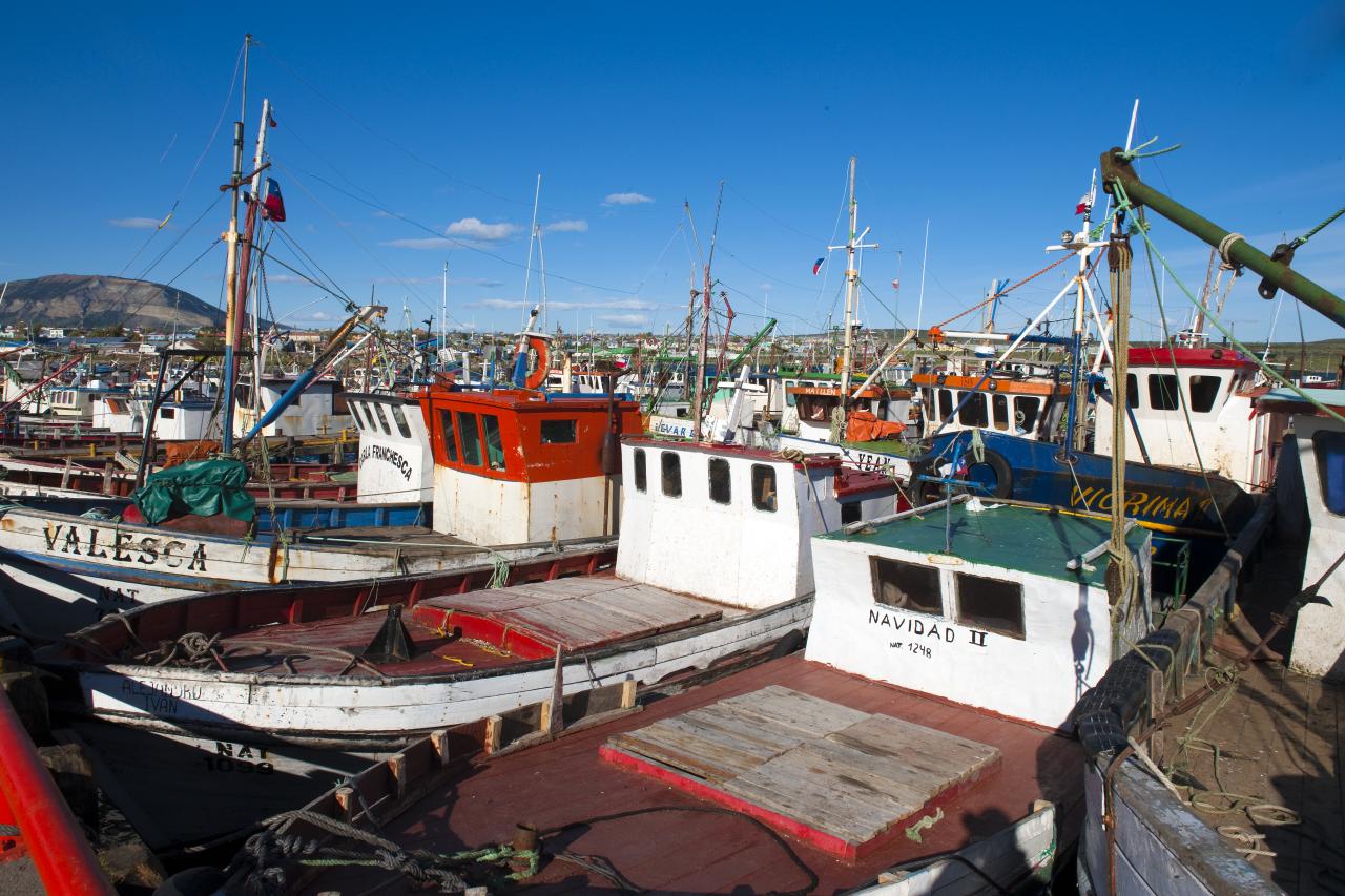 Photo: Puerto Natales Chile.jpg by Christopher Michel from San Francisco, USA (CC BY 2.0), via Wikimedia Commons
Most of Puerto Natales’ services cluster along Avenida Manuel Bulnes and the Costanera, the waterfront promenade running along Última Esperanza Sound. This is where you’ll find gear shops, hostels, restaurants, and the bus terminal – all within a short walk of each other, so you can restock and be back on the road fast.
Puerto Bories
 Photo: Puerto Bories-CTJ-IMG 6771.jpg by Christer T Johansson (CC BY 3.0), via Wikimedia Commons
About 5 km north of downtown, Puerto Bories was a company town built around a frigorífico – a sheep‑meat and wool‑processing plant run by the Sociedad Explotadora de Tierra del Fuego. Commercial operations wound down in the 1990s, and the historic brick complex, now a National Monument, has been converted into a boutique hotel and cultural space worth a stop even on a tight itinerary.
Cerro Dorotea
 Photo: Cerro Dorotea, Puerto Natales, 2019.jpg by Draceane (CC BY-SA 4.0), via Wikimedia Commons
On the eastern edge of town near the Argentine border, Cerro Dorotea is the local trailhead of choice for a half‑day hike with panoramic views back over Puerto Natales and Última Esperanza Sound, and – on a clear day – the Paine massif in the distance. It’s a solid warm‑up hike before you commit to multi‑day terrain in the park.
Top Things to Do in Puerto Natales
Torres del Paine National Park
Chile’s flagship wilderness sits 112 km north of town, anchored by the granite spires of the Cordillera del Paine and stitched together by glaciers, turquoise lakes, and windswept steppe. This is the reason you came to Patagonia – plan on multiple days if you’re tackling the W or O circuits.
Grey Glacier
Part of the Southern Patagonian Ice Field, Grey Glacier calves icebergs into Lago Grey from a face over 30 meters high and roughly 6 km wide before splitting in two. Hike the trail along the lake or book a boat or kayak tour to get close to the ice.
Cueva del Milodón Natural Monument
Twenty‑four kilometers northwest of town, this cave system made headlines in 1895 when the remains of a giant ground sloth (Mylodon darwini) turned up inside. It’s an easy half‑day detour on the way to or from the park, with a life‑size sloth replica for scale.
Puerto Bories
Five kilometers north of downtown, this former sheep‑ and wool‑processing complex once housed its own radio station, dairy, and worker housing for the Sociedad Explotadora de Tierra del Fuego. Now a National Monument, its industrial brick buildings have been repurposed into a boutique hotel and gallery you can walk through even if you’re not staying the night.
Última Esperanza Sound
This tidal fjord stretches from town toward Monte Balmaceda, draining much of Torres del Paine’s runoff through the Serrano River. Boat excursions run up the sound toward the glaciers at its head – bring a windbreaker, it earns its name in gusts.
Bernardo O’Higgins National Park
Chile’s largest protected area, at over 3.5 million hectares, borders Torres del Paine to the west and holds the Balmaceda Glacier, reachable only by boat from Puerto Natales. It’s the move if you want serious glacier views without the trekking crowds.
Book tickets & skip-the-line tours: Browse Puerto Natales experiences
Getting Around
 Photo: Terminal autobuses, Puerto Natales.jpg by Draceane (CC BY-SA 4.0), via Wikimedia Commons
From the Airport to Town
The nearest airstrip, Teniente Alfredo Parraguez (PNT), sits just a few kilometers north of the town. Regular shuttle services and shared taxis ferry travelers into the heart of Puerto Natales. Since the town is small, a simple walk from the drop‑off point will get you to most accommodations and the bus terminal.
To Torres del Paine and Beyond
The main artery out of town is the Ruta 9 highway, which runs east toward the park entrance. Daily buses and tourist shuttles depart from the central terminal, timed to match the early‑morning start of most treks. For those who crave flexibility, renting a 4×4 vehicle is common, but keep in mind that fuel stations are sparse and the road can be gravel‑ridden, especially in shoulder‑season weather.
Local Mobility
Within Puerto Natales, the streets are paved and pedestrian‑friendly. Bicycles are a viable option for short hops between the waterfront, the municipal market, and the trailheads that sit on the town’s outskirts. If you need to move heavy gear (tents, crampons, skis), most hostels and lodges will help you load it onto a taxi or a small van for a modest fee.
Safety & Practical Notes
Visa & Entry
U.S. citizens enjoy visa‑free entry for up to 90 days, as outlined by the U.S. Embassy – Entry and Exit Requirements. Your passport should be valid for at least six months beyond your planned departure date.
Currency & Language
Transactions are conducted in Chilean Pesos (CLP). While credit cards are accepted in most hotels and larger eateries, cash is king for market stalls, small gear rentals, and remote guide services. Spanish is the lingua franca; a few basic phrases go a long way, especially when coordinating with local outfitters.
Utilities
Tap water safety in Puerto Natales varies by source and season, so it’s prudent to boil or filter it rather than assume it’s potable, especially away from town. Bring a universal travel adapter (Chile uses Type C and L plugs, 220V) and a portable charger – the town’s power grid can be spotty during winter storms.
Health & Emergency
Chile’s national emergency numbers are 133 (police / Carabineros), 131 (ambulance / SAMU), and 132 (fire / Bomberos). The local health clinic can handle minor injuries, but for serious trauma you’ll need evacuation to Punta Arenas, which is a several‑hour drive away. Download a reliable offline map and keep the contact details of your embassy or consulate handy before you head into the backcountry.
Weather & Gear Prep
Patagonia’s weather is famously fickle. Even in summer, strong winds and sudden rain are the norm. Pack layered, waterproof gear, a sturdy pair of trekking boots, and a wind‑proof jacket. If you’re tackling the park’s high‑altitude routes, bring crampons and an ice axe – the glacier sections can be icy well into the austral summer.
The U.S. State Department rates Chile Level 2 (Exercise Increased Caution) (as of 2026-07-08). Keep normal city precautions in Puerto Natales itself, and separately plan for backcountry risk – weather, remoteness, and river crossings – once you’re out on the trails.
Best Time to Visit
 Photo: Torres del Paine - Janvier 2010.jpg by Martin St-Amant (S23678) (CC BY-SA 3.0), via Wikimedia Commons
While the data set doesn’t specify “best months,” seasoned trekkers know that the austral summer (December – February) offers the longest daylight hours and the most reliable trail conditions. However, shoulder seasons (October‑November and March‑April) bring fewer crowds and dramatic autumn foliage, at the cost of cooler temperatures and a higher chance of snow at higher elevations. Winter (June – August) is for the hardcore, with deep snow, limited services, and the need for full winter mountaineering gear.
Where to Stay
 Photo: Seno Ultima Esperanza.jpg by Guglielmo Celata (CC BY-SA 2.0), via Wikimedia Commons
Puerto Natales offers a spectrum of lodging, from rustic hostels that double as gear depots to boutique lodges with panoramic views of the Última Esperanza Sound. For a curated list of the top base‑camp hotels and lodges that cater to adventure travelers, check out our full hotel guide.
Gear up, check the weather, and let Puerto Natales be the launchpad for your next Patagonian conquest. Safe travels!
Frequently Asked Questions
Do I need a special permit to hike Torres del Paine?
Yes. All visitors must purchase a park entry ticket at the park's entrance. The fee supports trail maintenance and conservation.
Can I rent climbing or ski gear in Puerto Natales?
Gear rental shops exist, but inventory is limited and often booked out during peak season. It's safest to bring your own technical equipment, especially for specialized activities like ice climbing or backcountry skiing.
How reliable is the internet in town?
Most cafés and hostels provide Wi-Fi, but speeds can be inconsistent, especially during storms. Plan to download maps and offline resources before you arrive.
What's the safest way to travel to remote trailheads?
For most day hikes, the public shuttle from the central terminal is sufficient. For off-trail or multi-day routes, arrange a 4x4 transfer with a reputable local operator and always share your itinerary with your accommodation.
Are there any cultural considerations I should be aware of?
Patagonian locals are proud of their heritage and the natural environment. Respect signage, stay on marked trails, and practice Leave-No-Trace principles to preserve the pristine landscape that draws adventurers from around the globe.
Related Guides
Upcoming Holidays
ChileGet price-drop alerts and new guides from BoldTripGuide
One email a week: price drops on the gear we recommend, new guides, and what changed. No spam, unsubscribe anytime.